 Dealer Nearby
 Partner
Center
Partner
Center MENU
MENU
 Français
Hi-Target wins 70 sets of V60 GNSS RTK in Turkey for cadastral services
 2015-11-18


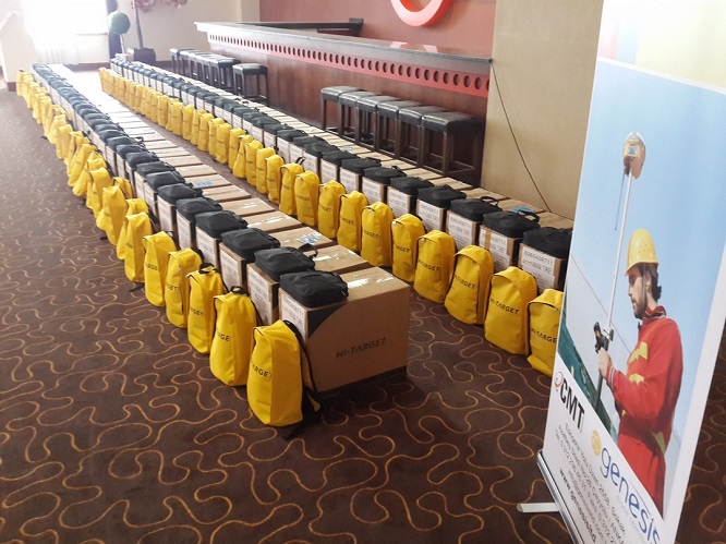
Guangzhou, China, Nov.16, Hi-Target, a professional high-precision geographic instrument solution provider in China won the bidding of 70 sets of V60 GNSS RTK purchased item of Turkey.
According to the requirements of General Directorate of Land Registry and Cadastre in Turkey, the GNSS systems shall execute each one of the static, rapid static, kinematic and Real Time Kinematic measurement methods, and shall operate in accordance with static and Real Time data. In addition, most of the receivers, tablets and GIS software will be used for Spatial Property System (MEGSiS) of TKGM. The V60 GNSS RTK of Hi-Target meets their requirements.
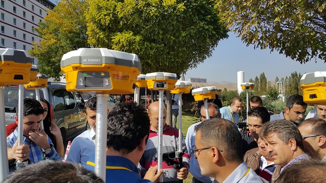
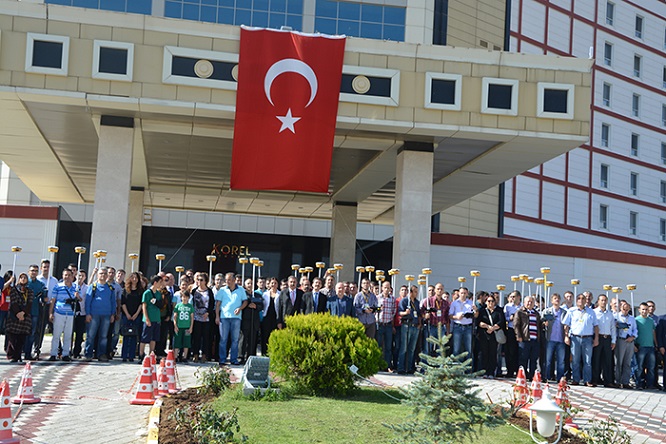
This tender absorbed many top GNSS brands from USA, Europe, and Asia once it was released officially. Hi-Target won the bidding of 70 sets of V60 GNSS RTK with overwhelming advantage. After winning the bidding, Hi-Target offered demonstration and training for the Turkish representatives, including V60 GNSS RTK functions and the software operations on the land management application. These instruments were supplied in a more economical, efficient and quality way as their requirements. Through this tender, Hi-Target and its product are verified to be outstanding in providing best solution in the international geographic market.
For more information, visit: http://www.tkgm.gov.tr/tr/harita
About V60 GNSS RTK
The V60 is a more compact design and higher-performance GNSS RTK system. It has basic features that other RTK system has, such as OLED display screen and standard memory. One of its key features is lighter and faster. Its rugged design can resist impact and vibration. With a smart speaker inside the receiver, its operation is fully automated. The DIY guiding voice can be customized in any language, even dialect! What’s more, the V60 is fully compatible with other GNSS RTK receivers from the world market. The static data can be saved directly in RINEX format.
For more information, visit: http://www.hi-target.com.cn/en/ProductInfo.aspx?id=85
About Spatial Property System (MEGSiS)
It is an open-source application developed by Land Registry and Cadastre General Directorate, where cadastre data are collected by the center system from local users in the cadastre offices in digital .cad format and are harmonized with land registry data in order to be submitted to stakeholder institution, organization, municipalities and citizens by e-government link. Studies held under Spatial Property System (MEGS?S) are collected under four main topics. i) Web-based application software ii) International standard map services iii) E-Government Services iv) Orthophoto Services.
About Hi-Target
Hi-Target is a professional high-precision geographic instrument solution provider in China. The company engages in GNSS high-tech technology industry, covering from GNSS technology development, to production as well as marketing and sales. In China, Hi-Target has established a nationwide sales and service network with 28 branches, 7 technical service centers. Hi-Target has 4 core businesses involved in surveying GNSS product series, digital sounder series, GIS data acquisition system, marine engineering application integrated system, marine surveying, and marine mapping software products.
 ©2025 Hi-Target and/or its subsidiaries and affiliates. All rights reserved.
